

Welcome to the Surveyor Reference Manual, a comprehensive guide designed for surveyors, engineers, and professionals involved in land measurement and mapping. This manual covers fundamental principles, tools, and methodologies essential for accurate and efficient surveying practices. It serves as a valuable resource for understanding the technical and legal aspects of surveying, ensuring professionals stay updated with modern techniques and ethical standards. Whether you’re a seasoned surveyor or a newcomer, this manual provides the knowledge needed to navigate the complexities of the field effectively.
1.1 Importance of the Surveyor Reference Manual
The Surveyor Reference Manual is a vital resource for professionals in the field, providing detailed guidance on surveying principles, legal frameworks, and technical methodologies. It ensures accuracy and compliance with regulations, helping surveyors navigate complex tasks such as property boundary disputes and geodetic measurements. The manual also serves as a reference for understanding emerging technologies like GPS and GIS, which are critical in modern surveying. By adhering to the guidelines outlined in this manual, surveyors can maintain high standards of professionalism and ethical practice, ensuring reliable and precise results in every project.
1.2 Overview of Surveying Principles
Surveying principles form the foundation of accurate land measurement and mapping. They involve determining property boundaries, topographical features, and spatial relationships between points. Fundamental concepts include triangulation, leveling, and distance measurement, ensuring precise data collection. Modern surveying integrates GPS, GIS, and total stations to enhance accuracy and efficiency. These principles guide professionals in resolving boundary disputes, planning infrastructure, and conducting geodetic surveys. Adherence to these principles ensures reliable results, making them indispensable in urban planning, construction, and environmental management. Understanding these principles is crucial for achieving accurate and legally sound survey outcomes.
Fundamental Concepts in Surveying
Surveying involves measuring land boundaries, distances, and angles to determine property lines and topographical features. It uses techniques like leveling, triangulation, and GPS for accurate spatial data collection.
2.1 Types of Surveys and Their Applications
Surveys are categorized into various types based on their purpose and application. Topographic surveys map physical land features, while cadastral surveys focus on property boundaries and legal descriptions. Hydrographic surveys measure water bodies, and geodetic surveys determine large-scale earth measurements. Construction surveys ensure accurate building layouts, and boundary surveys resolve property disputes. Each type requires specific tools and methodologies, ensuring precise data collection for legal, engineering, and environmental purposes. Understanding these survey types is essential for applying them correctly in different scenarios, from urban planning to natural resource management.
2.2 Key Terminology and Definitions
In surveying, understanding key terminology is crucial for accurate communication and execution. A benchmark refers to a reference point with known coordinates. Coordinate systems like latitude and longitude enable precise location mapping. Elevation measures height above sea level, while radius defines circular boundaries. Tie points are reference marks for alignment. Parcel describes a land division, and plat is a map showing property boundaries. Grasping these terms ensures clarity in survey planning, execution, and interpretation, making them foundational for all surveying activities and legal documentation.
Tools and Technologies in Surveying
Surveying relies on advanced tools like GPS, total stations, and GIS for precise measurements and data analysis. These technologies enhance accuracy and efficiency in modern surveying practices.
3.1 GPS and Its Role in Modern Surveying
GPS technology has revolutionized surveying by providing precise location data and enabling efficient fieldwork. Surveyors use GPS to determine coordinates accurately, reducing reliance on traditional methods. With real-time data and high accuracy, GPS facilitates large-scale mapping and integrates seamlessly with GIS systems. This technology enhances project efficiency, cuts costs, and supports complex surveying tasks, making it an indispensable tool in modern surveying practices.
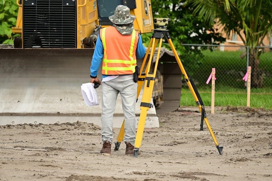
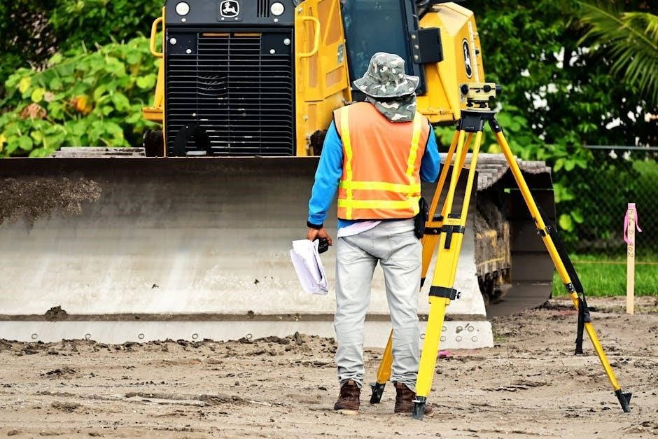
3.2 Total Stations and Their Functionality
Total stations are versatile surveying instruments combining a theodolite and electronic distance measurement. They measure angles, distances, and heights accurately, streamlining fieldwork. Equipped with data storage, they enhance efficiency by reducing manual calculations. Robotic models offer automated targeting and data transfer, improving precision. Their functionality supports topographical mapping, construction layout, and monitoring projects, making them invaluable for modern surveyors seeking accuracy and productivity in diverse applications.
3.3 Geographic Information Systems (GIS)
Geographic Information Systems (GIS) are powerful tools for capturing, storing, analyzing, and displaying geographically referenced data. In surveying, GIS enhances mapping by layering spatial data to create detailed, interactive maps. It supports data analysis for urban planning, environmental monitoring, and disaster response. GIS integrates with survey data, enabling precise location-based decisions. Its analytical capabilities help identify patterns and trends, making it indispensable for modern surveying applications that require data-driven insights and visualization. This technology bridges the gap between raw data and actionable information, revolutionizing how surveyors approach complex projects and share results effectively.
Survey Methodologies and Techniques
Survey methodologies and techniques encompass various approaches to land measurement, ensuring accuracy and efficiency. From traditional fieldwork to advanced technologies, these methods adapt to diverse project requirements and environments.
4.1 Geodetic Surveying Methods

Geodetic surveying methods involve measuring the Earth’s surface using advanced technologies like GPS and GIS. These techniques allow surveyors to determine precise locations and heights, ensuring accurate large-scale mapping. Geodetic surveys rely on reference frames to provide consistent data, crucial for projects spanning extensive areas. They are essential for infrastructure planning, environmental monitoring, and understanding geographical changes. By integrating with other tools, geodetic methods enhance data analysis, supporting informed decision-making in both public and private sectors. This approach ensures high accuracy and reliability in surveying projects.
4.2 Cadastral Surveying and Property Boundaries
Cadastral surveying focuses on determining property boundaries and ownership rights, essential for legal, administrative, and economic purposes. It involves measuring land parcels to establish clear titles and prevent disputes. Surveyors use historical records, legal documents, and physical markers to define boundaries accurately. Modern tools like GPS and GIS enhance precision in mapping and recording property lines. Cadastral surveys are critical for taxation, urban planning, and resolving boundary conflicts. They ensure that land ownership is legally documented, maintaining order and stability in property transactions and development projects.
Legal and Regulatory Frameworks
Understanding property laws and regulations is crucial for surveyors to ensure compliance and accuracy in defining boundaries. Legal frameworks govern land ownership, rights, and dispute resolutions, ensuring fairness and order.
5.1 Understanding Property Laws and Regulations
Property laws and regulations form the foundation of surveying, ensuring accurate boundary definitions and legal compliance. Surveyors must interpret statutes governing land ownership, rights of way, and easements. These laws vary by jurisdiction but aim to protect property rights and prevent disputes. Understanding zoning regulations, deed restrictions, and historical land use is essential. Compliance with these legal frameworks ensures surveys align with governmental and judicial standards, maintaining public trust and professional integrity. Staying informed about legal updates is crucial for surveyors to conduct ethical and legally sound surveys. This knowledge is vital for resolving disputes and ensuring property transactions are lawful and precise.
5.2 Handling Boundary Disputes and Legal Recourse
Boundary disputes often arise from unclear property lines or conflicting claims, requiring surveyors to provide precise documentation. Legal recourse may involve mediation or court action, with surveyors serving as expert witnesses. Understanding property laws and historical records is crucial for resolving disputes fairly. Surveyors must ensure their findings comply with regulations, providing clear evidence to support legal decisions. Effective communication and adherence to ethical standards are vital in such situations, helping to maintain trust and integrity in the resolution process. Accurate surveys and legal expertise are essential for achieving satisfactory outcomes in boundary disputes.
Best Practices for Surveyors
Adhere to industry standards, maintain precise measurements, and uphold ethical practices. Utilize modern tools like GPS and GIS for accuracy. Ensure safety and professionalism in all tasks.
6.1 Ensuring Accuracy and Precision in Surveys
Ensuring accuracy and precision in surveys requires meticulous planning and execution. Use GPS and GIS tools for reliable data collection, and double-check measurements to minimize errors. Document all processes thoroughly, and calibrate equipment regularly to maintain consistency. Adhere to industry standards and best practices to guarantee results are trustworthy. Understanding legal and technical requirements is crucial for avoiding disputes; By combining modern technology with traditional surveying methods, professionals can achieve high levels of accuracy, ensuring the integrity of their work and meeting client expectations effectively.
6.2 Safety Protocols and Professional Ethics
Adhering to safety protocols and professional ethics is paramount in surveying. Always wear protective gear and ensure secure working environments to prevent accidents. Follow local regulations and maintain transparency in all dealings. Uphold ethical standards by avoiding conflicts of interest and ensuring impartiality. Respect property rights and privacy during surveys. Document all findings accurately and maintain client confidentiality. Continuous professional development is essential to stay informed about industry advancements and ethical practices. By prioritizing safety and ethics, surveyors build trust and uphold the integrity of their profession, ensuring reliable and responsible outcomes.

Future Trends in Surveying
Surveying is evolving with advancements in AI, drones, and GIS, enhancing accuracy and efficiency. These tools enable faster data collection and more precise land assessments.
7.1 Emerging Technologies in Surveying
Emerging technologies like GPS, GIS, and drones are revolutionizing surveying by enhancing accuracy and efficiency. These tools enable real-time data collection, 3D mapping, and automated analysis, reducing manual errors and saving time. AI is also being integrated to interpret large datasets, improving decision-making. Additionally, advancements in laser scanning and unmanned aerial vehicles (UAVs) provide high-resolution imagery and precise measurements. These innovations are transforming traditional surveying practices, offering faster, cost-effective, and more reliable solutions for modern challenges in land management and development.
7.2 The Role of AI and Drones in Modern Surveying
AI and drones are transforming modern surveying by enabling faster, more accurate, and cost-effective data collection. Drones equipped with high-resolution cameras and sensors capture detailed aerial imagery, while AI processes this data to generate 3D models and analyze land features. AI algorithms can identify patterns, predict trends, and automate tasks like boundary detection and volume calculations. Drones also enhance safety by reducing the need for human presence in hazardous areas. Together, these technologies are streamlining workflows, improving precision, and enabling real-time decision-making in surveying projects, making them indispensable tools for the future.